Bonita Canyon Sports Park, Newport Beach
SHORT RIDE
MEDIUM RIDE
LONG RIDE

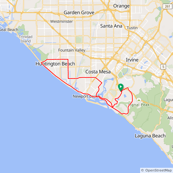
S2

29 Miles. Flat to Rolling ride thru Newport Beach, Shady Cyn Trail, Irvine & Tustin.
S3

27 Miles. Flat to Rolling ride thru Newport Beach, Shady Cyn Trail, Irvine & Tustin.

M1

34 Miles. Flat to Rolling ride thru Newport Beach, UCI, Irvine & Tustin.
1000 Feet Elevation Gain.
M2

38 Miles. Hilly ride thru Newport Beach, up Newport Coast, Laguna Beach, Laguna Hills, Lake Forest & Irvine.
1840 Feet Elevation Gain.
M3

34 Miles. Rolling ride thru Newport Beach, up Shady Cyn & Turtle Rock, Irvine & Tustin.
M4
38 Miles. Rolling to Hilly ride thru Newport Beach, up Newport Coast, north to Huntington Beach returning thru Costa Mesa.
1100 Feet Elevation Gain.
M5

38 Mile ride thru Shady Canyon, Quail Hill, Irvine, Laguna Woods, Laguna Beach, Newport Coast - Pelican Hill, Corona Del Mar, Back bay and Eastbluff. 2400 feet of elevation gain.
M6

39 Mile ride up San Joaquin Hills, down Newport Coast to PCH to Laguna Beach, up Laguna Canyon to El Toro over to Laguna Woods and Laguna Hills, Lake Forest, Irvine Spectrum, Quail Hill, University Park and Eastbluff. 2000 feet of elevation gain.
M7

39 Mile ride thru Shady Canyon, Irvine Spectrum, Great Park, Tustin Ranch, UCI and Eastbluff.
M8

39 Mile ride thru Newport Beach, Irvine, Tustin Ranch, Portola Springs, Great Park, Quail Hill and Shady Canyon. 1600 Feet of elevation gain.
M9

40 Mile ride thru Newport Beach, Irvine, Portola Springs, Great Park and University Park. 1500 feet of elevation gain.
M10

38 Mile ride thru Turtle Rock, Irvine Spectrum, Lake Forest, North Laguna Hills, Laguna Woods, Laguna Canyon, Emerald Bay, Corona Del Mar, Back bay and Eastbluff.
M11

40 Mile ride thru Newport, UCI, Irvine, Tustin Ranch, Portola Springs, Great Park, Lake Forest, Irvine Spectrum, University Town Center and Eastbluff. 1300 feet of elevation gain.
M12

38 Mile ride thru University Park, Oak Creek, Great Park, Walnut trail, Irvine, Back Bay, Newport Beach, Balboa, ferry ride over bay, Bayside, Avocado and San Miguel. 900 feet of elevation gain.
L1

43 Miles. Flat to Rolling ride thru Newport Beach, Irvine & Laguna Beach.
1600 Feet Elevation Gain.
L2

47 Miles. Hilly ride thru Irvine, Lake Forest, Mission Viejo, Laguna Hills, Laguna Beach & Newport Beach.
2600 Feet Elevation Gain.
L3

43 Mile rolling hill ride out Bonita Canyon, around Turtle Rock, thru Irvine Spectrum and Lake Forest back thru Great Park and up to Portola Springs. Returning thru Great Park, Irvine, University Park and Eastbluff. 1800 feet of elevation gain.
XL1

50 Miles. Hilly ride thru Irvine, Lake Forest, Mission Viejo, Laguna Niguel, Laguna Beach & Newport Beach.
2575 Feet Elevation Gain.
XL2

56 Miles. Flat to Hilly ride up Newport Coast, San Joaquin Hills, Spy Glass Hill then heading west on PCH to Belmont Shores and returning on PCH.
1640 Feet Elevation Gain.
DIRECTIONS: Bonita Cyn Sports Park, Newport Beach (4)
- Take the 55 Freeway south to the 73 Freeway and exit on MacArthur Blvd.
- Go south on MacArthur for 0.9 miles and the turn left on Bonita Canyon Rd.
- Go 0.4 miles and turn right on Mesa View.
- Turn left at end of street onto Ford Rd.
- The Park is located on the left at the first stop sign.